Because It’s There – Circling Mt. Shasta in a Day
In August this year, Bicycle Law colleagues Miles and Maryanne Cooper took their kids to Mt. Shasta for some time in the wilderness before school started again. While there, Miles rode around the base of Mt. Shasta, taking advantage of the wide network of forest service roads. For anyone interested in following along on a map, or for the .gpx file as the foundation for doing the ride, it can be found at www.strava.com/activities/3904027082. The following is his ride story.

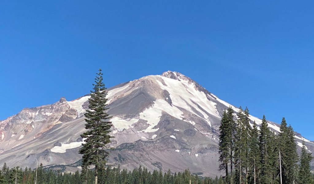
Mt. Shasta in August.
MT. SHASTA, A VOLCANIC MOUNTAIN IN NORTHERN CALIFORNIA, commands attention as a massive presence visible from hundreds of miles away. Within its sphere of naming influence is a California county, the state’s largest reservoir, a river, a town, and countless businesses. Despite this, and despite all the attention paid to it by naturalists like Joaquin Miller and the Sierra Club, Mt. Shasta did not receive its national wilderness designation until 1984. What took so long? Mt. Shasta missed its opportunity to become a national park in 1916 when it was upstaged by the 1915 volcanic eruptions of its neighbor, Mt. Lassen. Because the National Park Service criteria for new parks required them to be unique, Mt. Lassen’s inclusion resulted in Mt. Shasta’s exclusion. As a result, Mt. Shasta and the surrounding areas were overseen by the Department of Agriculture’s National Forest Service, also known as the United States Forest Service.
The Forest Service’s mission is to “… sustain the health, diversity, and productivity of the nation’s forests…” (emphasis added.) That word, productivity, is significant. Unlike national parks and wildernesses, national forests can be grazed and logged. What does this mean for cyclists? Extensive, unpaved road networks, mapped out in detail on publicly available USFS maps.
We are typically an Eastern Sierra family, so my knowledge of the Mt. Shasta area was non-existent. As a result of our family history in Red’s Meadow (near Mammoth Lakes) and Yosemite, the east side’s stark beauty, and a bit of my own myopia, we tend to focus on destinations along Highway 395 for mountain experiences. This year was unusual, however. Perhaps an understatement for the experiences 2020 has surprised folks with thus far… So this summer we found ourselves with a few days in the Mt. Shasta area. Our friends who lent us their house left a Mt. Shasta area USFS map in a prominent location, sitting not too far from a Mt. Shasta history book. I found myself immersed in both.

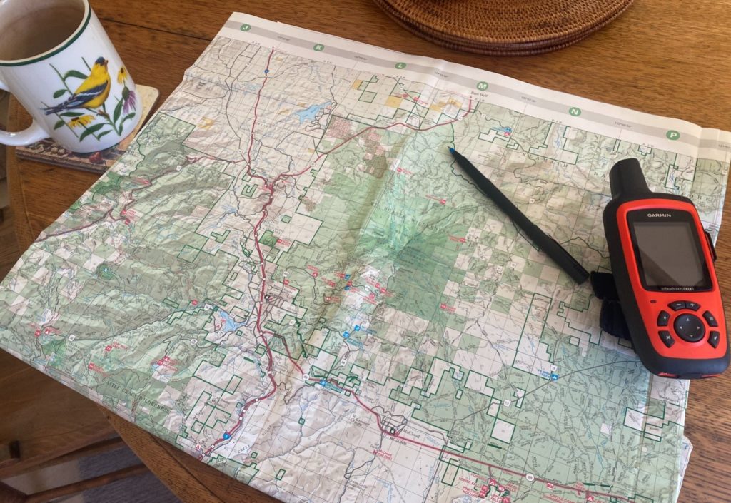
Prep work.
The map, printed on water-resistant plasticine material, is fantastic for inspiring exploration. An accomplished cyclist I know recently called this mapsterbating —and while her term might be a tad edgy, it hits the nail on the head. As I poured over the map, I could not help myself from starting to make some rough calculations. Using paved secondary roads on the north and west sides and unpaved USFS roads on the south, one could circumnavigate the mountain. The route would be between 60 and 90 miles. These were rough calculations since the house we were at was in a communications dead zone. No WiFi, one bar, sometimes… Normally, I use a variety of tools prior to hitting unfamiliar terrain. Google Maps for loose mileage and elevation change estimates and Google Earth flyovers to inspect road conditions.
Alfred Korzybski coined the phrase, “The map is not the territory,” repeated by Robert De Niro in Ronin. Very true with USFS maps. What appears as a road on a USFS map can sometimes be overgrown, washed away, or simply nonexistent. The takeaway here should not be to distrust USFS maps —they are pretty damn amazing. But on any off-the-beaten path route, improvisation will be necessary. The technologic dead zone meant I would be heading out with less detail than usual.
I HAD COME PREPARED, HOWEVER. I had an inkling I might adventure on one of our days in Shasta. Maryanne recognizes that my mood is generally better if I thrash myself in the wild every so often. I had brought a Garmin inReach —a satellite-based device that provides mapping, texting, and an emergency beacon. With it, one has communication capacity in places cell towers don’t reach. The Garmin made it possible for Maryanne to spot my dot on a map as I made my way around the mountain. This was important. Usually I ride with someone during adventure travel. The planned route put me 20 miles away from any help, on roads that saw no traffic. I wanted to be able to communicate should an untoward event occur. Another benefit —the Garmin was loaded with a digital version of the USFS maps.
After some discussion and a weather consult, I arrived upon a plan that took the weather into account. Our trip coincided with a heat wave, and I wanted to avoid the over-100-degree lower-elevation afternoon temperatures. That meant leaving a little before 5 a.m. and running the route counterclockwise. This had the dual benefits of knocking the paved portions out during low-traffic hours as well as getting through the lower elevations early. The southeast portion of the route climbed to 6,000′ and then rolled between 5,000′ and 6,000′, where the daytime temperature was expected to be in the far more tolerable mid-80s. I expected to be back by 2 p.m. I was to text by 3 p.m. to provide a status report if I ran behind. If Maryanne had not heard from me by 5 p.m. nor been able to raise me, it would then be time to send someone out to see why that Garmin dot was not moving.
The night before I prepared the bike. The Garmin got strapped to the handlebars. The USFS map went in the handlebar bag —because paper never runs low on batteries. I pumped the tubeless tires to 40 psi. The rig was set up with Schwalbe G-One Allrounds 700 x 35s, with hydraulic disk brakes and a 2 x 10 drivetrain. Everyone has opinions on builds. My opinion? Ride what makes you happy. This bike makes me happy. The tires were perfect for everything but a roughly one-mile soft sand/dust stretch on the east side. Yes, you could go wider on this ride. But tires required to surf the sand, for me anyways, would have been problematic. My late model rig pre-dates the wider tire era, precluding anything much bigger than 35s, even with 650b wheels.
On the water front, I erred on the side of caution. There was a good refill spot at City Park in the town of Mt. Shasta —the spring known as the Sacramento River’s headwaters —but it came up relatively early in the trip. I carried two bottles and used a seat pack where I stowed a full Platypus 2.5 liter collapsible canteen. Arkel’s Seatpacker with its quick release metal frame did a nice job of eliminating tail wag from the significant water weight. I also brought a Steripen for water purification as a backup, but given the late season was unsure what water I’d encounter. I’d learn by the end of the ride that two bottles and the Steripen would have been plenty with the creek crossings I came across, but carrying a few extra pounds beat the risk of dehydration.
THE NEXT MORNING, AFTER AN EARLY ALARM and a cup of tea, I rolled out into the dark. I flicked on a high-lumens rear flashing light and a small headlight—the sun would be up in another hour and a half—and connected to Highway 97. Known as one of the area’s volcanic legacy byways, the 97 was a two-lane highway connecting Weed to Klamath Falls. While less scenic than most of the roads on my cue sheet, the 97 served as a direct route to knock out some of the paved mileage quickly at an hour when one couldn’t see much anyway. At that hour, there was light traffic—a truck rumbling by every few minutes or so. And with the highway’s wide shoulder, it was bearable.
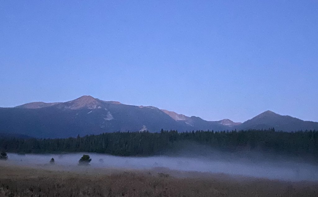
Weed came up quickly. I crossed under the I-5. As I paralleled the I-5 on two-laned South Weed Boulevard, I noticed the road surface. Remarkably robust, even if not perfectly maintained. It turns out this section was the old I-5 prior to the highway expansion. As first light bloomed, the fields came into view, with a specter of fog hovering above. Then onto a connector gravel road that appears as public on maps, despite residents posting “No trespassing” signs.
No trespassing signs on quiet gravel stretches are not uncommon, even when those roads appear on the map as publicly accessible. They pose a dilemma. The signs seem to go up when residents want to discourage through vehicle traffic. Each one requires its own consideration. Could the map be wrong? Do I hear aggressive dogs barking down the road? Is it a part of the country where the only warning you’ll receive is a blast of birdshot to the backside? I tend to proceed with caution, and if confronted, apologize for being lost—unless that confrontation is an aggressive dog—that then provides a sprinting opportunity. Fortunately, though, as a cyclist, I rarely experience anything other than a friendly wave from a field on such roads.

First light and fog along the old I-5.
A left turn at the end of the gravel connector put me onto Old Stage Road. The road climbed to reach its own version of Black Butte summit, then dropped. A few miles, and then a veer left onto Abrams Lake Road, across the I-5, and then a right on Spring Hill Road. It was now around 6:30, and I encountered two separate road cyclists, saying a quick hello to each. These would be the only cyclists I would see along the route.
At the end of Spring Hill, I turned into City Park to refill my first nearempty bottle. Water coursed out of a spring, the Sacramento river’s headwaters, and a plaque described the vast Sacramento river watershed, extending down into the Central Valley. I rock-hopped into position, filled the bottle, and got back underway on Mt. Shasta Road, through town. The next stop wasn’t far. At the foot of Old McCloud Road, also marked as USFS 31, was a coffee shop that opened early. Masked up, I got a cup of coffee and a bagel.
While sipping coffee, I took advantage of the strong cell connection to download an offline version of the Mt. Shasta area in Google Maps to my phone. Garmins are great, but the user interface is lacking. I can usually figure out the next turn at a questionable five-way intersection far more quickly with Google’s offline maps.
AFTER THE SHORT BREAK, IT WAS TIME TO CLIMB. The next 11 miles climbed from 3,500′ to 5,500′. This section of 31, from the town of Mt. Shasta to the ski area turnoff, was paved. And empty. As I climbed up and east, the sun broke through every so often, shafts of light piercing the trees. I did not see another person from the time I finished my coffee until a couple miles before I rejoined Highway 97, several hours later. As I reached the turnoff for the ski area, 31 turned to gravel. The gravel road hugged the mountain, curving in and out of its folds, descending a little before resuming a slow, steady climb to the high point at 6,000′.
It was along the short descent that I ran into the only company I would meet for many miles. An old SUV was parked off the road. The doors were open, but no one was visible. Eight beautiful huskies were milling about, and as I got within 50 yards they got up and padded toward me.
“Hello?” I called out as I came to a stop. Despite the open doors, no one responded. By this point, the dogs had formed a loose, curious circle around me. Seeing no one, I began a slow roll. Four of the dogs fell in right behind me. This continued as I returned to my prior pace. After about a half mile, two dogs dropped off. Two continued. They stayed with me for another mile before they lost interest. My best guess was they were part of a sled team. Why they were summering in Mt. Shasta’s heat with their thick fur was anyone’s guess.
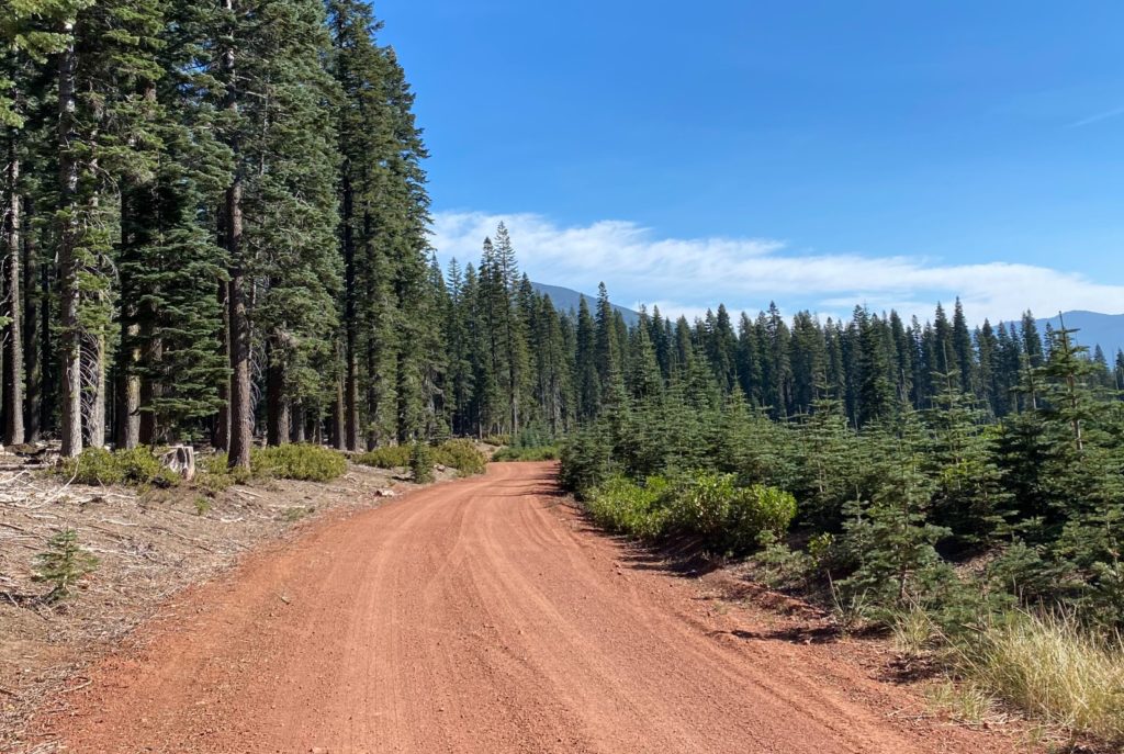
After parting ways with the dogs, I encountered the first of two creek crossings. Mud Creek lived up to its name, my tires sinking deep into the muck before I managed to get across. Failing to clear the crossing on two wheels, I instead focused on the positive—the opportunity to cool down as I walked through the water. A few turns later, the road emerged from the mountain’s folds, thick trees and gray volcanic rock giving way to sunlit red roadway.
A FEW MILES LATER, Ash Creek afforded an opportunity for creek crossing redemption. This water, clear and quick-moving, looked ideal for a bottle refill with a purifier. With the water in my seat pack, however, I had enough to finish the tour around the mountain despite the increasing temperatures. As I rolled through the creek, the front tire met a few submerged baby head rocks, stopping my progress. I put a foot down and walked the rest of the way across.
The 31 then joined Military Pass Road. Military Pass Road has been around a relatively long time for a road in the west. Knowing I was traversing the same territory that John C. Frémont and his party had used nearly a hundred fifty years ago made me feel connected to a different era. Despite Military Pass Road’s history, I attempted a lesstraveled western road to stay closer to the mountain. I found the fire road shrink down to double track, then single track, then no track before the meager game trail made its way back to Military Pass Road, however. I believe a local could have connected the Brewer Creek trailhead road to the Andesite logging road to the Bolam logging road to avoid what came next on Military Pass…but I am not a local.

The sunlit red roadway along the 31.
As I rejoined Military Pass Road, I encountered the route’s most challenging road conditions. Here, the road rolled across a section of pumicite. That’s volcanic ash, or fine sand, resulting from broken down pumice. And yes, I had to look that up. Sections were compressed by vehicle tires and rideable, but those stretches were short-lived. Afterseveral dismounts and remounts, I decided it was more efficient to simply walk. Up until this point I was well ahead of schedule. I wondered how much sand remained. With the temperature rising and another eight miles to Highway 97, I hoped it was not much.
It turned out to be about a mile. Not a bad hike-a-bike ratio for such a spectacular ride. After that, the road dropped, turning into a rougher, rocky descent. Over the next eight miles to Highway 97, the road lost 1,700′ in elevation. It was in this section I saw the only person I met in the backcountry, a man driving a pickup loaded with firewood. He waved a friendly hello as he went by. Then under a railroad trestle—Amtrak’s Coast Starlight goes through here on its way to Klamath Falls—and out onto the highway.
Between the elevation drop, the arid volcanic land northeast of Shasta, and the afternoon hour, the temperature had rocketed up. I pulled onto Highway 97, continuing the descent, and made good time. A few miles later another gravel opportunity opened to the right, and I got away from traffic on Juniper Terrace and then Quarry Road before heading into the small township where we were staying. Home by 1 p.m, as the temperature reached over 100 degrees. Plenty of time to play Jenga with the kids before dinner… As I sat with the kids, portions of the ride kept replaying in my head. This was an adventure I would treasure for quite some time.
Have you or someone you know been involved in a bicycle crash? Curious about your rights? Are you a lawyer handling a bicycle crash who wants more information on how to get the best result for your client? Contact Bicycle Law at (866) 835-6529 or info@bicyclelaw.com.
Bicycle Law’s Bob Mionske is licensed to practice in Oregon, its affiliate Coopers LLP has lawyers licensed in California, and either can affiliate with local counsel on bicycle cases across the country to make sure cyclists get the benefit of lawyers who focus on the issues specific to bicycle incidents.
